 Industrial sites in Zeravshan Valley, Tajikistan
Each year, more than 3 million people in Central Asia are affected by storms, floods, landslides and earthquakes. As global temperatures rise over the next decades, glacier melt is expected to heighten the risk of floods, mudslides and cause the loss of valuable water sources in the countries of the region: Kazakhstan, Kyrgyz Republic, Tajikistan, Turkmenistan, and Uzbekistan. Average summer temperatures are forecasted to persist above 30 degrees Celsius in some parts of the region, triggering more frequent droughts. In Tajikistan, for example, the annual probability of climate-related droughts could increase tenfold to over 30% by the end of this century. In Kazakhstan, the number of people exposed to extreme river flooding is expected to rise by 72% in the next two decades.
What can Central Asian countries do to prepare for these impacts, now and in the future? Along with climate adaptation measures, countries in the region need to enhance their disaster preparedness by investing in green and resilient infrastructure projects, as well as increase regional cooperation to tackle transboundary natural hazards. They also need information and data to guide their decisions.
"Along with climate adaptation measures, countries in Central Asia need to enhance their disaster preparedness by investing in green and resilient infrastructure projects, as well as increase regional cooperation to tackle transboundary natural hazards."
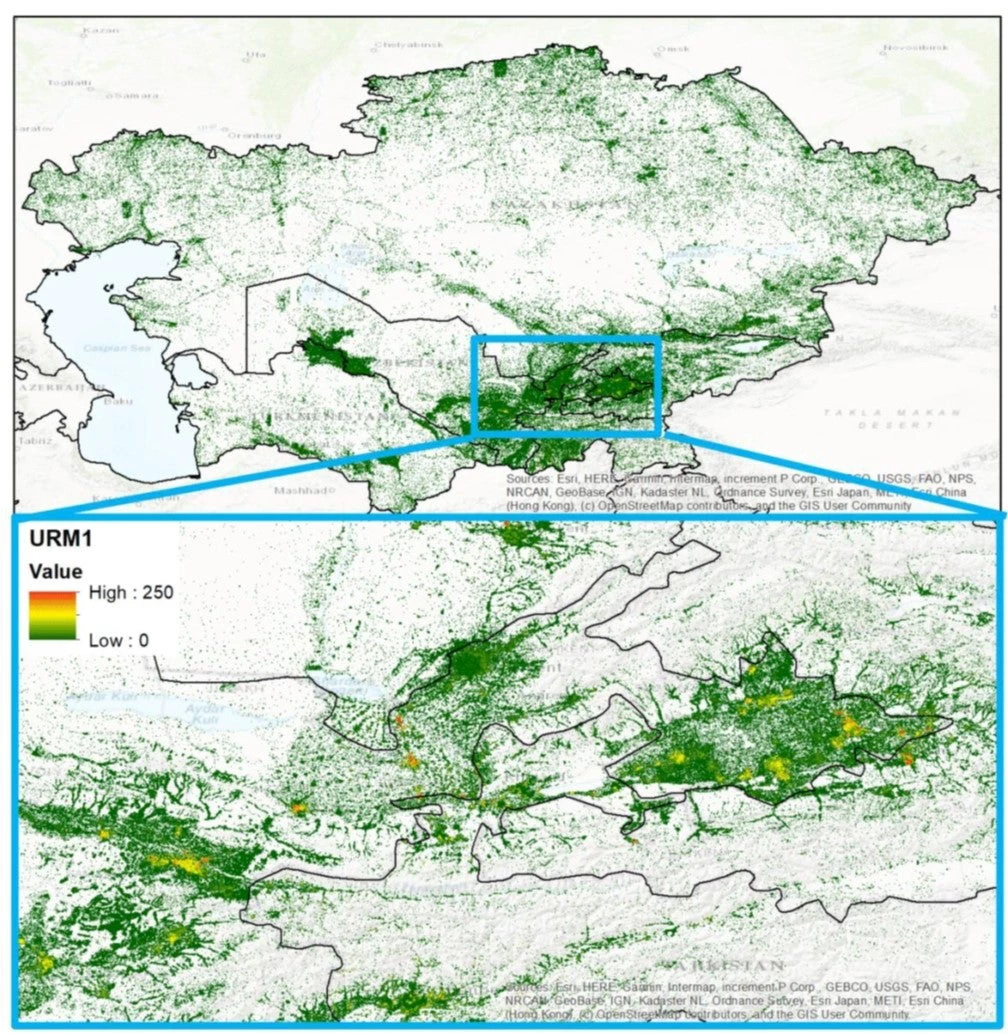
Over the last four years, the World Bank and the Global Facility for Disaster Reduction and Recovery (GFDRR) have been helping the region build resilience through the Strengthening Financial Resilience and Accelerating Risk Reduction in Central Asia Program (SFRARR), funded by the European Union. The program produced a regional multi-hazard risk assessment that generated a vast amount of knowledge and data on earthquake, landslide, and flood hazards related to rainfall and rivers, as well as exposure and vulnerability data. This information is empowering national decision-makers to develop risk-informed prevention and preparedness measures to protect citizens, infrastructure, and the wider economy against climate and disaster risk; it is expected to guide policymakers for years to come and is essential to generate accurate and reliable risk assessments. The data and reports are publicly available in the World Bank’s Risk Data Library.
Investing in regional knowledge and skills
Besides generating critical data, the SFRARR program also made a significant investment in building regional knowledge and skills. The program established a reciprocal knowledge exchange and delivered 17 country-level and regional workshops, training sessions, and report presentations on how to manage natural hazards. This training covered several topics including: instruction on how to understand risk data and assessment methods on hazard, exposure, and vulnerability; the fundamentals of disaster risk financing and available risk transfer instruments; and the adaptability of national social protection systems. The workshops encouraged information flow from the program to an array of national stakeholders including government officials, local practitioners, academia, students, and the private sector, and introduced participants to innovative tools and best practices.
In return, knowledge and expertise shared by local experts has helped the program and its implementing partners better understand the specificities of local challenges and ensured that the data and knowledge produced are applicable to the needs of each country and the region.
The feedback from national participants has been especially encouraging, indicating that the workshops, tools, and data provided have been relevant to their current work.
“Compared with other assessments in the region, SFRARR has produced a meticulous assessment of the regional disaster risk; in future this can provide a forum to enhance technical knowledge of the Ministry of Emergency Situations’ decision-making staff in reading and visualizing data on exposure, vulnerability, and disaster risk,” said Almabek Aidakeev, Head of the Secretariat of the National Platform of the Kyrgyz Republic on Disaster Risk Reduction.
Central Asia remains vulnerable to many natural hazards. With increasing climatic risks, enhanced disaster risk resilience is vital to saving lives and preventing economic losses. Capacity building is key to strengthening the region’s climate and disaster risk preparedness, as such resilience will help sustain progress beyond the duration of the SFRARR Program.


Join the Conversation