For many Pacific Island countries, natural disasters such as cyclones and tsunamis, are an all-too common occurrence. Out of the top 15 most at-risk countries for natural disasters globally, four are Pacific Island countries, and Vanuatu is consistently at the top.
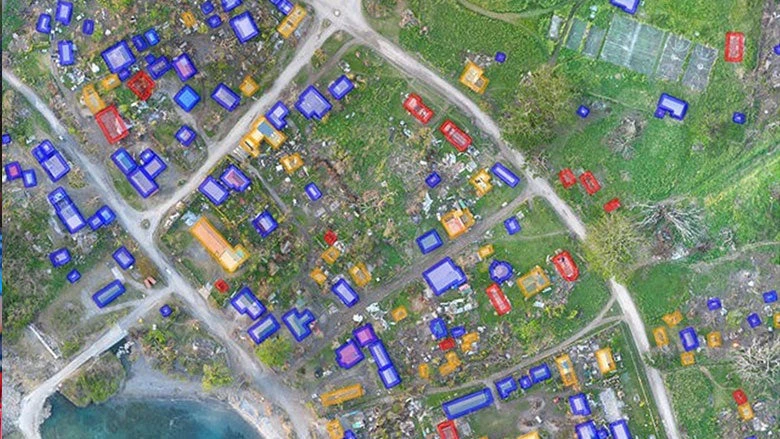
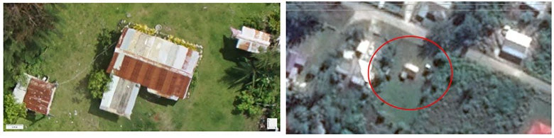
In 2015, Cyclone Pam hit Vanuatu, and knowing the extent of damage was vital for the government to identify and plan reconstruction needs. A team of Unmanned Aerial Vehicle (UAV) experts were sent out to quickly establish credible estimates of the damages and losses. Many damage reports were already available from the field, but with varying quality, and the challenge was to consolidate and verify them, within a very tight timeframe. Cloud cover also prevented us from getting satellite images, so we mobilized two UAV teams to fly below the clouds and capture high-resolution footage showing the impacts on the ground in the worst affected islands in Tafea and Shefa province.
Challenges continued throughout, from needing to coordinate airspace with those flying relief goods into affected areas, to transferring massive datasets over low internet bandwidths. But with team-effort and ingenuity, solutions were found; the UAV teams were able to capture valuable damage footage within sampled areas during the day, which were analysed overnight by volunteers of the Humanitarian Open Street Map (HOT) and the Digital Humanitarian Network; new workflows were developed to collate the data and to feed the outputs into the Post-Disaster Needs Assessment.
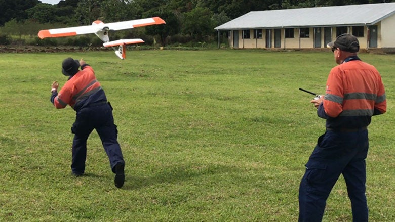
Our experience in Vanuatu made it clear that field tests in a non-disaster situation were needed to complement our learning and build local capacity. This fast-developing technology is great for disaster resilience in remote locations, such as the Pacific, and our team is currently field testing UAVs in Fiji and Tonga, looking at operational workflows, data needs, accuracy, required resolution vs area covered, ease of use and post-processing requirements, as well as coordination mechanisms with the Civil Aviation Authorities and other relevant government agency stakeholders. The tests are being carried out in close collaboration with the Pacific Community (SPC), the National Emergency Management Office Tonga, the Ministries of Land, Surveying, Natural Resources and Environment (Tonga). The Civil Aviation Authority of Fiji and Tonga, and VTOL-aerospace, an Australian UAV company and OpenAerialMap and is supported by the European Union (EU) in the framework of the Africa Caribbean Pacific-EU Natural Disaster Risk Reduction Program, managed by the Global Facility for Disaster Reduction and Recovery (GFDRR).
The tests are pushing the boundaries and reflect how they are likely to be used for pre- and post-disaster mapping, including high-resolution digital elevation mapping under dense vegetation or steep terrain, collecting shallow bathymetry for storm surge modelling and the use of UAVs over long distances such as to remote outer islands. To meet these challenges, multiple platforms and sensors have been used, and a team of experts is assessing all stages of the process as well as the final products to ensure they are fit for purpose.
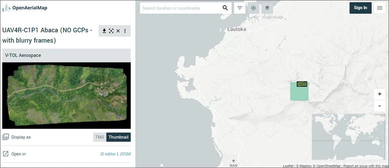
The resulting imagery will be available as open data on the OpenAerialMap platform. In addition, the results of the field tests along with lessons learned and best practices will form part of a dedicated Guidance Note. The Guidance Note will also be an integral component of subsequent training provided by World Bank partners.
The current field tests in Fiji and Tonga are giving us the space to learn and develop processes specific to each country’s needs and are aligned with World Bank requirements. The lessons learned and key findings will be shared widely with the global UAV community and contribute to establishing best practices. The key will then be to localize these processes, and build and scale local skills across the Pacific to enable the use of UAVs for disaster resilience. Localization is key to long term sustainability.
Related:


Join the Conversation