
Schools across Bangladesh are highly vulnerable to floods, cyclones, and earthquakes. How can the country mitigate and respond to the risks of these natural hazards?
By using the GeoDASH platform - a geospatial data sharing platform - the Directorate of Primary Education of Bangladesh has assessed 35,000 schools with respect to the type of infrastructure, water and sanitation facilities, access to roads, and overall capacity during natural disasters.
The GeoDASH platform is a reliable and extensive geographic and information (geospatial) data network.
These data are Geographic Information System (GIS) and other geolocation services-based information to represent objects or locations on a globally referenceable platform to enable mapping.
For example, locations of road network data can be merged with the flood risk map to get a single map for identifying vulnerable road communication in flood-prone areas.
This type of data will allow the Government of Bangladesh, communities, and the private sector to create, share and use disaster risk and climate change information to inform risk-sensitive decision making.
Previously, there was no active collaboration for location mapping and collecting data among government organizations and institutions in Bangladesh. The respective agencies primarily stored geospatial data on non-networked computers or locally networked servers, and often it would not be available after certain years due to the absence of data management.
So how can Bangladesh get access to reliable and extensive geospatial data?
One possible answer might be to develop a spatial data infrastructure (SDI) and visualization platform to facilitate government and external partners to make better, geospatially informed policy and programmatic decisions.
This is the rationale for GEODASH, supported by the Global Facility for Disaster Reduction and Recovery (GFDRR).
The data platform was launched in 2014 as a web-based application for collating, storing, and sharing geospatial data. It is based on the free and open source software GeoNode.
The World Bank, supported by GFDRR, conducted monthly working group sessions with multiple government agencies to establish a catalog of existing datasets as well as a data sharing protocol through GeoDASH.
The next challenge was the sustainability and security of the platform. The working group highlighted broader government support for sustainability and data security. In December 2015, ownership of GeoDASH was transferred from GFDRR to the Bangladesh Computer Council (BCC), which now hosts the platform.
Currently, 47 government, international/non-government organizations are registered on the GeoDASH platform and share many interesting data.
For example, Department of Disaster Management has shared the cyclone-induced storm surge inundation depth layer which could be used for creating cyclone risk maps with vulnerable infrastructure (e.g., primary schools). These risk mapping efforts will inform larger investments in resilience and help to invest in cyclone shelters cum primary schools with access to roads.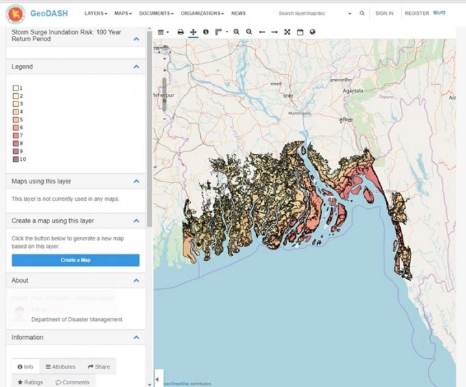
GeoDASH is being used as the base platform and primary tool for the National Spatial Data Infrastructure Policy supported by the Japan International Cooperation Agency. With this policy, GeoDASH is expected to institutionalize geospatial data sharing in all relevant Bangladesh government agencies. This will encourage greater openness of non-sensitive data to all, and support broader open data policy reform to benefit the people of Bangladesh.

Join the Conversation