This is part of a series of blogs focused on the Sustainable Development Goals and data from the 2016 Edition of World Development Indicators. This blog draws on data from the World Bank’s Rural Access Index and on results presented in the report Measuring Rural Access: using new technologies
In Nepal, 54 percent of the rural population lives within 2 kilometers of an all season road.
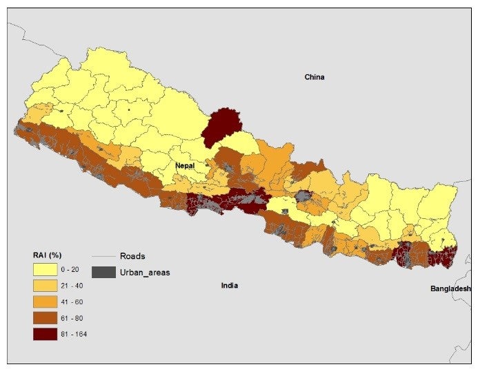
Just over half of the rural population in Nepal lives within 2 kilometers of a road in good or fair condition as measured by the Rural Access Index (RAI) in 2015, leaving around 10.3 million rural residents without easy access. The map shows how the RAI varies across the country: in the southern lowlands, where both road and population density are high, the RAI is around 80 percent in some districts. In the more rugged northern regions, lower road density and poor road quality leave many disconnected, resulting in a low RAI figure – in many places less than 20 percent.
Limited road access hinders productive livelihoods
The vast majority of farmers in many low-income countries are still disconnected from local, regional and global markets. Limited access to a good road network can restrict agricultural production to subsistence levels. It also impacts the ability of rural businesses and enterprises to compete with others in less remote areas.Target 9.1 of the Sustainable Development Goals seeks to develop quality, reliable, sustainable and resilient infrastructure, including regional and trans-border infrastructure, to support economic development and human well-being, with a focus on affordable and equitable access for all. In the short term enhancing one aspect of decent infrastructure - rural road connectivity - reduces transport costs and improves access to markets and social facilities such as schools and hospitals. In the longer term it elevates agricultural productivity, business profitability, and employment, which reflects the aims of SDG Target 2.3 - doubling the agricultural productivity and incomes of small-scale food producers. Better connectivity also strengthens the resilience of rural populations to natural and human-made shocks and disasters by facilitating the movement of people and supplies for faster recovery.
Measuring access through new technologies
The Rural Access Index, which was established over ten years ago, is a robust way to measure countries’ progress towards these SDG targets. The RAI measures the proportion of people who have access to an all-season road within 2 kilometers (km), considered a reasonable distance for people’s normal economic and social purposes.
While previously measured through a relatively costly and spatially unrepresentative household survey approach, recent advances in technologies are now allowing better assessments of the RAI’s components – population and road distributions, and road quality.
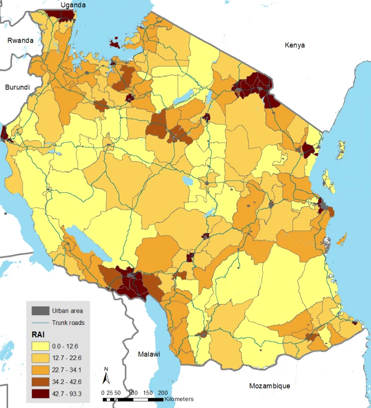
In Tanzania, for example, the original RAI was based on data from just 409 villages, a small sample to represent a country of nearly a million square kilometers. However, by using data from WorldPop , which integrates census, survey, social media, and administrative data with satellite and other spatial datasets to produce high-resolution population distribution data, the RAI can now be based on the accessibility of every 100m x 100m square of land. Similar leaps forward in spatial and other technology means that the transport infrastructure in many countries can now be mapped through digitized road network data.
Road quality data have been difficult to collect in remote areas in the past. The RAI focuses on all-season roads, which are “motorable all year round by the prevailing means of rural transport (often a pick-up or a truck which does not have four-wheel-drive), with some predictable interruptions of short duration during inclement weather (e.g., heavy rainfall) allowed. While such explicit data may not be readily available, traditional road assessments surveys can now be combined with new methods such as smartphone apps which assess the roughness of a road while driving on it, and satellite imagery which can map remote road conditions. The new RAI method also takes advantage of more common parameters in existing databases, such as the International Roughness Index (IRI), Pavement Condition Index (PCI), and visual assessment using four or five categories (excellent, good, fair, poor, and very poor).
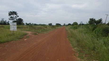
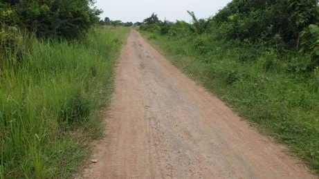
These three components are spatially combined to produce new RAI data at the subnational level, and produce more accurate results than the previous household survey method.
Around 33 million rural residents in Tanzania are unconnected to good roads
A changed picture of rural access in surveyed countries
Eight countries in Africa and Asia were surveyed both at the conception of the RAI, around 2006, and again a few years later. In around half, a greater proportion of the national populations are now thought to have good road access with higher RAIs than previously (Bangladesh, Nepal, Kenya and Uganda), while in the other countries (Ethiopia, Mozambique, Tanzania and Zambia) more suffer from remoteness than previously estimated. Overall, around 174 million rural dwellers in the eight countries surveyed are without good access, out of a total population of over 470 million.
Comparisons of spatial data illustrate how a lack of access may correlate with regions of poverty
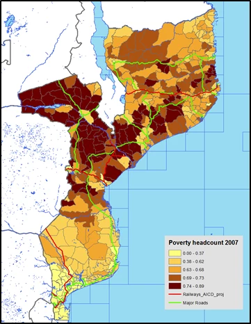
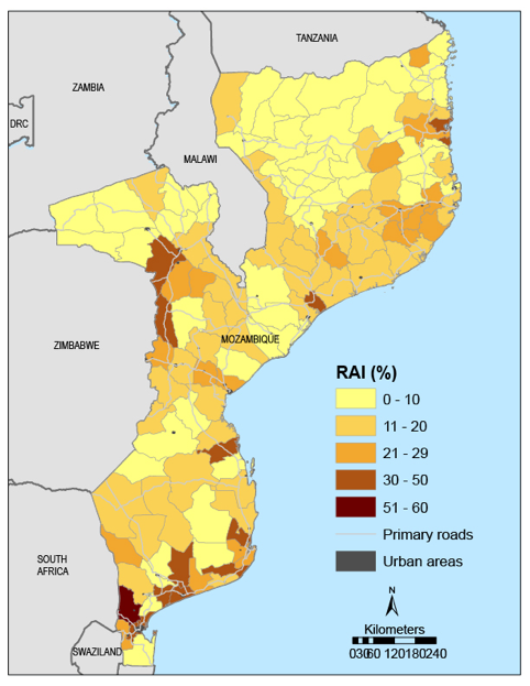
In Mozambique a fifth of the rural population is estimated to live within 2 kilometers of an all-season road, which means that about 15 million rural residents lack access. A comparison with poverty mapping data shows that the RAI in Mozambique is low where poverty incidence is high. Although causality remains debatable, comparing spatial data visually in this way is a useful tool.


Join the Conversation