 Nearly two weeks ago, a Boeing B777-200 of the Malaysian flag carrier Malaysia Airlines vanished with no trace. Flight MH370, the regular daily flight between Kuala Lumpur and Beijing, carried 239 persons on board and was under the command of a highly experienced crew. The flight never reached its destination, and an unprecedented search for the overdue aircraft was launched. Initially the search concentrated on an area in the South China Sea where the last position was received. However, the search area was progressively enhanced covering the Bay of Bengal, large parts of the Indian Ocean, and several territories over China and Central Asia. NASA was involved to scan the earth surface analyzing every object over 30 meters, and even the public at large is invited to analyze satellite data on the internet.
Was the aircraft victim of an accident or was its disappearance a result of terrorism? Was it shot down, hijacked by intruders or the crew, did it ditch and sink rapidly as a consequence, or did it land successfully at one of the 634 runways on its theoretical pathways suitable for a B777 to be stowed away and held for ransom? We might not know the answer to these disturbing questions for months and years to come. However, the travelling public is astonished to learn that the B777 of flight MH370 was not under active surveillance. How can it be that in times where anybody can be located homing on a cell phone a commercial airliner just gets lost?
Since the end of World War II, air traffic has been surveyed by radar. Primary radars pick up the reflection of an electronic beam from an aircraft to determine its position. This technology has its limitations given a range of only 70 nautical miles. Aircraft have therefore been equipped with transponders that respond to radar inquiry. These secondary radar systems typically range up to 250 nautical miles. If an aircraft flies outside of the range of a radar station, such as over the open sea or remote areas, so called procedural air traffic control, which involves position reports and estimates, is used to control air traffic. Nevertheless, unknown to the travelling public, most of the commercial air traffic is not under active control for a large amount of a given flight.
The industry has developed the Aircraft Communication Addressing and Reporting System (ACARS), on which operators can transmit via satellite aircraft data from anywhere in the world on a privately operated network. Typically, only engine data are regularly sent for analysis during a flight to a carrier’s base and to the engine manufacturer, and some company communications (text messages) are done. However, given that this private sector communication solution is expensive, airlines limit the usage of these services and don’t send other data, such as position reports, over these networks.
Over 10 years ago, a new technology called Automatic Dependent Surveillance – Broadcast (ADS-B) has been developed in the United States. With ADS-B, each aircraft will be equipped with a digital transmitter reporting its position and other parameters every second to a simple ground based receiver. The new system costs less than 10 percent of traditional radar systems, and it allows following any aircraft continuously. Trials in Alaska have been so successful that the American Federal Aviation Administration (FAA) has made the system mandatory on all aircraft in the United States by 2020. Today, about 60 percent of commercial airlines are equipped with ADS-B, but only a few countries (e.g. USA, Australia) have ground installations to receive the signals. To address the lack of surveillance over remote areas where no ground installations are possible, private operators are currently developing satellite systems that could pick-up and rebroadcast ADS-B at reasonable cost. Would flight MH370 have been equipped with ADS-B, the search would have been a question of hours, as the reference point would have been the point of its last transmission seconds before disappearance.

Schematic of ADS-B Systems
The Bank is currently implementing the
Pacific Aviation Investment Program (PAIP). Several PAIP countries are receiving ADS-B systems, equiping both aircraft and ground stations, to implement air traffic surveillance at a fraction of the cost of radar in these developing aviation markets. Despite the fact that the system is not yet satellite based, it already greatly improves safety as most regional flights never leave the range of the ground stations. This approach allows emerging countries to leapfrog constraints related to mainstream transportation technology by using modern ICT technology.
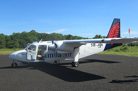
Aircraft operating between the Pacific Islands, like this Britton Norman, will be equipped with ADS-B allowing constant surveillance
Learn more:

Join the Conversation