At the December 2009 Copenhagen climate change conference, Saad Hariri, then Prime Minister of Lebanon, announced his country’s new target for renewable energy: 12% of the national energy mix, to be achieved by 2020. This prompted an intense wind-mapping effort that concluded a year later, with an estimate that Lebanon’s onshore windpower potential is 6.1 gigawatts (GW)—more than a third of current consumption—said Pierre El-Khoury, Manager of the Lebanese Energy Ministry’s Center for Energy Conservation.
El-Khoury outlined Lebanon’s wind-mapping exercise at a Washington workshop on renewable energy resource mapping hosted by the Energy Sector Management Assistance Program (ESMAP) May 9. The Lebanese wind atlas, developed in collaboration with GL Garrad Hassan and Partners, and financed by UNDP and Spain, has identified eight optimal sites for wind farms, of which three will be selected for development. El-Khoury and others cited the government commitment to a target for renewable energy as a “main driver” of the resource mapping that followed.
Given the scale of investments being made in renewable energy—about $260 billion worldwide in 2011—thorough resource-mapping helps energy planners identify the best locations for wind farms, solar facilities and small-hydro sites. With oil and gas, it is obvious that one pumps where the reserve is found. But with renewable energy sources, finding the most abundant sites, where power can be tapped most efficiently, is not so obvious. Combine that with the need to link the resource to the national transmission network, accommodate environmental constraints such as migratory bird corridors, as well as demand centers, and you have a complex mapping challenge. But such a map is a vital tool in crafting a clear renewable energy strategy and plan to guide developers.
El-Khoury’s was one of several presentations at the ESMAP event on mapping of wind, solar and hydropower resources, delivered by government officials, technical experts and service providers. “Better assessments of renewable energy resources lower the cost of renewable energy,” said workshop moderator Pierre Audinet, ESMAP’s clean energy program manager. “This is critical area that needs more support.”
“The cost is minimal compared to the investments themselves,” said workshop participant Arnaud Desmarchelier, senior engineer at the Agence française de développement, adding that mapping, “can deliver a difference in returns of millions.”
The three mapping methodologies are each sciences in themselves. Wind mapping usually starts at the meso-scale, using satellites and ground-based measurements. This cascades down to micro-scale measurement of wind speeds by developers to better assess promising sites.
Solar mapping also starts with satellite data gathered over decade-long periods, which is then combined with year-long ground data to identify specific locations at which light intensity is combined with low cloud cover, taking into account other factors such as dust.
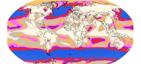
A pioneering effort on solar and wind maps was launched over a decade ago, with UNEP’s Solar and Wind Energy Resource Assessment, or SWERA. “These SWERA maps (for 13 countries) stimulated policy discussions that would not have taken place otherwise,” said Dave Renne, President of the International Solar Energy Society. He added that effective mapping which enables informed decisions on the location of solar farm sites, combined with improved solar technologies, can help developers mount solar energy generation facilities that approach grid parity.
The same kind of mapping is available for hydropower too. Douglas Hall, of the Idaho National Laboratory, described the geospatial analysis behind a comprehensive assessment of the hydropower potential of natural streams across the United States, as well as Brazil, both of which are available online. The Millennium Challenge Corporation contracted the Idaho laboratory to do a similar assessment of Malawi’s natural streams. Many other developing countries could use this kind of knowledge to develop mini-hydro to deliver clean electricity at remote locations.
“There is a need for added stand-alone efforts to support renewable energy resource mapping,” concluded Pierre Audinet of ESMAP. “A robust assessment of resources removes uncertainty, and this can be a catalyst for action by governments and developers.”
ESMAP, a trust fund financed by 13 bilateral donors and managed by staff co-located in the Bank’s Sustainable Energy Department, plans to mobilize additional support for technical assistance to resource mapping over the next year.
Image: Wind map from the UNEP Solar and Wind Mapping Assessment

Join the Conversation