Reducing greenhouse gases (GHGs) is urgently needed to mitigate climate change. The Intergovernmental Panel on Climate Change (IPCC) has highlighted the need for steep emissions reductions to keep global warming below 1.5° C. The World Meteorological Organization forecasts that the current trend in GHG emissions will increase global temperature by 3–5° C by the end of this century. This would far overshoot the 2-degree limit pledged by the 2015 Paris Climate Accords and might have a catastrophic impact (World Bank 2012).
Atmospheric methane (CH4) is a potent GHG that traps heat much more efficiently than carbon dioxide (CO2) and has 28 times more impact on temperature than the equivalent CO2 emissions. By volume, CH4 currently represents only 3% of anthropogenic CO2 emissions, but has accounted for 23% of the radiative forcing in the lower atmosphere since 1750. This increase in emissions has come mainly from agriculture, fossil fuel production and use, and waste disposal. The much shorter atmospheric duration of CH4 compared to CO2 provides a critical opportunity for GHG reduction in the atmosphere over the next few decades. So CH4 management should be an important part of any climate mitigation strategy.
The recently launched Global Methane Pledge joins 122 countries in a collective effort to reduce global CH4 emissions by at least 30% from 2020 levels by 2030. The Pledge highlights the rapid reduction of CH4 emissions from energy, agriculture, and waste “as the single most effective strategy to keep the goal of limiting warming to 1.5˚ C within reach while yielding co-benefits including improving public health and agricultural productivity” (photo 1).
Photo 1. Primary sources of increased CH4 emissions
Unfortunately, pledges to reduce emissions of CH4 and other GHGs confront a striking information shortfall at the outset: near-total absence of directly measured data for problem diagnosis, program design, and performance assessment. National reporting has relied almost entirely on voluntary disclosure of emissions calculated by bottom-up methods that apply engineering parameters to estimated activity levels in emissions-generating sectors. However, the advent of satellite-based GHG measurement has greatly expanded the potential for empirical assessment.
Using satellites to support the measurement of CH4 reduction
World Bank researchers developed a new database and open data service for tracking CH4 emissions building on earlier carbon emissions work. The database responds to the SDG Decade of Action, which calls for broadening global access to policy-critical data and demonstrating their use. It uses information from the European Space Agency’s Sentinel-5P (S-5P) (TROPOMI) satellite platform, which provides reliable information on global CH4 emissions at high levels of spatial resolution. Research has shown that S-5P CH4 measures correspond closely to independent measures taken at ground stations maintained by TCCON (Sha et al. 2021). S-5P completes 14 Earth orbits per day, with a 1-day site revisit time.
While CH4 data from S-5P can be downloaded at no cost, readying the data for emissions tracking requires significant processing. This includes filtering concentration anomalies (i.e., the effects of local emissions) from global trends in atmospheric CH4 (map 1).
Map 1. Post-filtering of CH4 concentration anomalies in 2020

Constructing and processing the data
The World Bank’s open data service pre-filters the CH4 data and publishes spatially referenced, monthly mean concentration anomalies for the entire terrestrial world. The database employs S-5P’s L2 Offline georeferenced measure of XCH4, the column average dry-air mixing ratio of methane, corrected for bias associated with surface albedo. It filters the data for local concentration anomalies or differences between observed and background CH4 at each observation point, following the methodology of Hakkarainen et al. (2019).
CH4 data at your fingertips
With gridded data at 25 km resolution, the database can support analyses for states, provinces, urban and rural areas, and project areas. It can incorporate user-defined area boundaries, as well as standard boundaries for administrative areas. The system can be a useful tool for World Bank studies, such as the Country Climate and Development Reports; priority area analysis for emissions reduction; and research by global stakeholders on CH4 emissions sources and changes over time.
Operational data use
With the potential increase in resources to finance climate mitigation work in the coming decade, the World Bank and other development partners will need systems to support data-driven decisions. The CH4 emissions data can be critical for estimating emissions from paddy fields, livestock, industry, and waste disposal. These data, in turn, can be used with cost-effective impact approaches (e.g., payment for results programs) to incentivize and monitor emissions reductions, especially in the developing world. Global platforms for data and analytics can support this work by improving decision transparency and facilitating performance benchmarking for countries’ climate mitigation investment programs, including those supported by the World Bank and other development partners.
New insights for Global Methane Pledge participants
The added value of satellite-based data for priority-setting depends on the comparative accuracy of estimated sectoral outputs and emissions intensities from bottom-up inventories. To date, priority-setting for emissions reduction has been based on national or global emissions inventories that combine sectoral activity data with broadly calibrated emissions factors. Using such spatial inventories as EDGAR, policy analysts can identify emissions-intensive areas, trace emissions to specific subsectors, and perform benefit-cost assessments of alternative technologies for emissions reduction.
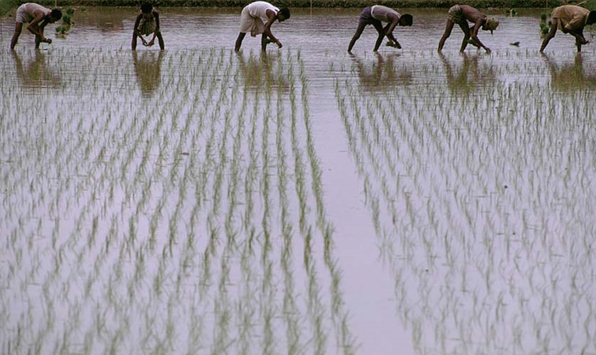
A new World Bank paper compares S-5P and EDGAR data in a global study of CH4 emissions from irrigated rice production, which accounts for about 10% of agricultural CH4 emissions. The results suggest that the S-5P data supplement the EDGAR data with more granular spatial information, which may support local programs to track, verify, and reward the adoption of CH4-reducing rice production techniques. If this approach proves valuable for irrigated rice production, we believe it can work for other CH4 sources as well.
With increasing satellite missions in the coming decade, we expect an increase in both free and subscription data services related to CH4 and other GHGs to facilitate new insights and action on climate mitigation.
The authors gratefully acknowledge financial support from the Knowledge for Change Program.


Join the Conversation