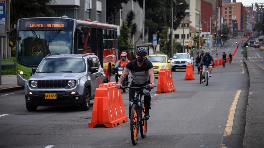
The coronavirus (COVID-19) and lockdown measures have created immense challenges for urban transport. But they also provide an opportunity for cities to rethink the future of mobility. Cycling, in particular, is enjoying renewed attention. This is not surprising, as biking offers many advantages that make it an attractive form of urban transport both during and after the pandemic: bicycles can ease the pressure on public transit systems, allow for easy social distancing, contribute to better public health, and reduce air pollution.
Yet we have a long way to go before cycling can become a mainstream transport option for urban residents. Motorized transport is often the default choice—even to destinations within easy cycling distance—and most observers are concerned that traffic will come right back once the virus subsides.
One major obstacle is infrastructure… or the lack thereof. Even in cities that have actively promoted cycling, such as Rome, Paris, or Bogotá, cycling networks are often fragmented, forcing cyclists to make use of busy and dangerous roads. Over the past decade, Bogotá, has constructed 500 km of bike paths, locally known as ciclorrutas. These have contributed to a big increase in daily cycling trips, from 421,000 in 2011 to 635,000 in 2015. Despite this investment, gaps in the network and maintenance issues continue to affect the paths’ usage and residents’ overall mobility.
If we’re serious about harnessing the full potential of cycling, it’s essential that cities address these issues and connect disjointed bike paths into cohesive, user-friendly networks. But where do you start? With limited fiscal resources, which parts of your city should you focus on to expand biking infrastructure? How can you ensure cycling investments benefit the highest number of people?
To answer these questions, urban planners traditionally rely on online or household surveys. But these are slow and expensive, often taking months or years from initial data collection to the planning stage. Recent advances in digital technology, however, are creating new ways to collect and analyze data. Insights from anonymized mobile phone data are particularly promising.
In our latest research together with the Secretaria de Movilidad de Bogotá and UC Berkeley, we used Bogotá as a case study to show how mobile phone data can improve our understanding of mobility patterns and inform the planning of new infrastructure. We first tapped into data from a local fitness app called Biko to analyze how cyclists move around Colombia’s capital and identify the biggest gaps in the ciclorrutas. We also mined data from cell towers to get a better picture of overall mobility across all modes, including private cars, public transport, and walking. We found that there are 4.1 million short- to medium-length journeys across the city every day that could be completed using a bicycle instead of a car. This clearly demonstrates that potential demand for cycling in the city is much higher than the 635,000 average trips in 2015.

Our analysis found a clear link between the presence of bike paths and the number of cycling trips tracked through Biko, while the inclusion of cell tower data highlighted how gaps in the ciclorrutas impacted the volume of potential cycling trips. We also noted that the cycling situation varies significantly from one neighborhood to the next depending on the socioeconomic context: this is particularly evident across low-income areas south of the center, where bike paths are less common and cycling accounts for a smaller proportion of trips vis-a-vis its potential. Hence the paper recommends prioritizing infrastructure investment in the southern area and in a series of specific links throughout the city to address the potential demand, where a lot of short trips are happening that are well-suited for cycling.
Already a cycling champion in its region, Bogotá is now better equipped to design a more comprehensive cycling network that would fit the projected demand and provide citywide connectivity. In an ideal scenario, that means cyclists would be able to complete their journeys safely and seamlessly without having to leave a bike path.
More broadly, our research demonstrates how mobile phone data can help gain insight into mobility trends and anticipate future needs. If used properly, Big Data can lead to better decision-making, improve development outcomes, and help decision makers respond quickly and effectively to unexpected challenges such as COVID-19. And of course, as more and more people carry phones in their pockets, the approach we piloted in Bogotá can easily be replicated elsewhere.
Whatever the post-COVID reality looks like, it’s safe to say that data-driven planning will become an integral part of our new normal. We are excited to see what Big Data has in store for urban transport, and we stand ready to help cities make the most of it.
Want to learn more about our methodology and findings? Please refer to our paper, “A data science framework for planning the growth of bicycle infrastructures” (Transport Research Journal, Volume 115, June 2020). It was written in collaboration between the World Bank, the University of California at Berkeley and the Secretaria de Movilidad de Bogotá.


Join the Conversation