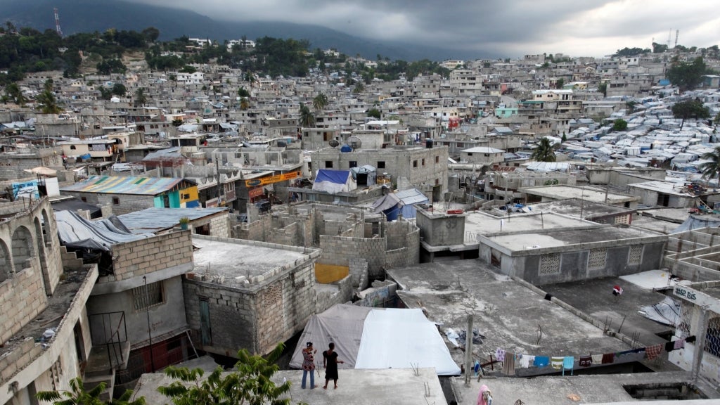
On 12 January 2010, Haiti was struck by a force 7.0 Mw earthquake approximately 25 kilometers west of the capital of Port-au-Prince. It is estimated that over 225,000 people were killed by the earthquake, and over 1 million displaced. Ten months later, Christchurch, New Zealand, was also struck by a similar 7.1 Mw earthquake, but in this case, no fatalities were reported. Countries struck by equally powerful disaster events are affected differently in terms of the devastation caused, the number of casualties, persons displaced, and impact on livelihoods. There are many underlying reasons, but one key factor that can certainly improve the country’s odds to withstand a devastating earthquake is the quality of its land and geospatial systems which underpins strong preparedness, supports swift emergency responses and enhance the pace of reconstruction and recovery.
Before the 2010 earthquake, the recording of property rights in Haiti was weak, and there were problems with proof of titles. Reference and record systems were often unclear, incomplete, or out of date. The land titling system was not computerized. Banks could not use contested properties as guarantees. Land administration, land use planning, zoning, building codes, and property valuation were all in need of strengthening before the earthquake. Possession was often the only tool available to defend property rights. Relief work in Haiti was partly hampered by the poor state of geospatial data, and uncertainty over land rights prevented the reconstruction of some infrastructure, which has had long-lasting impacts. The many lessons from this disaster have informed efforts to improve land administration going forward.

New Zealand had a mature, reliable land administration system and an advanced authoritative national spatial data infrastructure in place prior to the earthquakes and so could make informed decisions about which properties could be repaired and which should be abandoned. Most owners had private insurance cover, and a valuation infrastructure enabled compensation for the value of lost homes and businesses to be calculated. The building codes and town planning systems minimized earthquake damage and casualties.
When disasters displace people and they are forced to leave their homes behind, land records can offer critical protection of their property rights. This is crucial, since land and homes are usually the main assets that people have and being able to return to homes—and for that matter, farms and businesses—is essential for recovery. Receiving compensation for what has been lost enables people to start again and rebuild; however, without land records, there is no inventory of what has been lost.
Similarly, geospatial information is essential. Without this, even the most basic rebuilding post-disaster is impossible. Restoring road networks, transportation, water supplies, and sewage systems requires detailed data about topography, elevation, soil stability, and subsurface structures. At its most basic, if those trying to undertake relief work lack maps of the areas they are working in, rescue efforts will be compromised, and the provision of emergency aid made difficult.
Land and geospatial information is extremely valuable for resilience but to produce it and effectively use it, right systems need to be in place: a Land Administration System that provides current, reliable, and complete land tenure, land valuation, land use, and land development information, and a sustainable National Spatial Data Infrastructure (NSDI)—that provides comprehensive and authoritative geospatial information. Moreover, Land and geospatial systems are of no use in disasters unless the systems themselves are resilient so that data and access to data are not lost in a disaster event.
Two years ago, the Global Land and Geospatial Unit embarked on a journey to explore the role that land, and geospatial information takes in the context of improving resilience to disasters. The effort culminated in the publication of the report “Solid Ground: Increasing Community Resilience through Improved Land Administration and Geospatial Information Systems”.
The report partly reflects the findings and lessons learned from nine country case studies, multi-stakeholders’ consultations and an international symposium in partnership with the University of Melbourne. It also draws on lessons learned from emergency responses, recovery and reconstruction activities in countries that have experienced disaster events, The findings of the report and the operational tools that were developed for it, are currently being utilized in Solomon Islands, Kerala State (India), Punjab State (Pakistan) and Lao PDR to enhance their land and geospatial systems and improve their resilience to disasters.
Disasters happen. There is nothing humanity can do to prevent earthquakes, tsunamis, or volcanic eruptions from occurring, and even disasters with a human cause may strike suddenly and without warning. However, communities and populations can be made more resilient in the face of disaster through building resilient land and geospatial information systems. Like in Haiti, where Land Administration projects have been implemented to strengthen security of tenure and community mapping efforts have created a publicly and readily available basemap that has become the default map for organizations responding to crises. Undoubtedly, these systems play a key role at the forefront in all disaster risk management (DRM) phases by providing land-use, building, value, and zoning data for disaster risk modelling, monitoring, planning, and mitigation, as well as a platform to implement decisive actions before, during, and after disasters.
Learn more:
- Global Facility for Disaster Reduction and Recovery (GFDRR)
- Solid Ground: Increasing Community Resilience Through Improved Land Administration and Geospatial Information Systems
- The role of geospatial information in confronting COVID-19 – Learning from Korea
- When disasters displace people, land records and geospatial data are key to protect property rights and build resilience
- A disaster that could have been avoided: Enhancing resilience with land and geospatial data


Join the Conversation