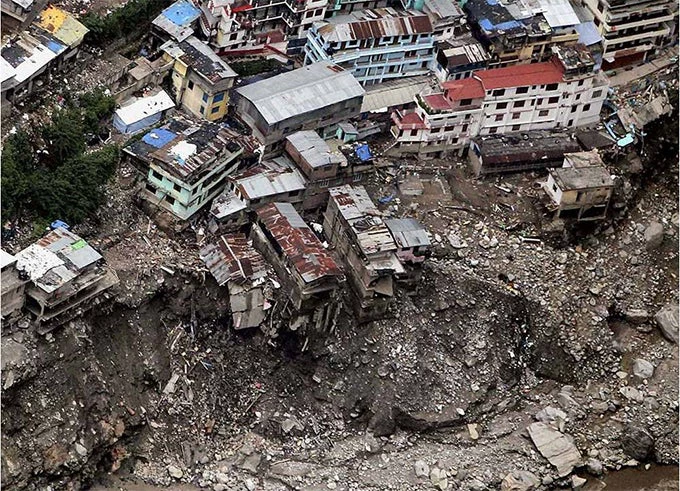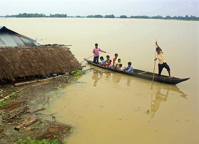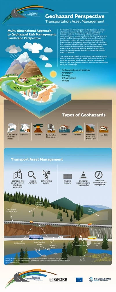
Most geohazards are linked to climate activity such as rainfall and thawing of ice or snow. In many places, recent climatic changes have increased the intensity of rainfall and raised mean temperature, increasing hydrological hazards, such as debris or earth flows, erosion, and floods.
South Asia is particularly vulnerable to geohazards. A study completed in 2012 found that from 1970 to 2000, the number of geohazards quadrupled in the region, resulting in damages of over $25 billion in 2008-2012 alone.
This week, the World Bank Group in partnership with the Global Facility for Disaster Reduction and Recovery and the European Union, will gather at a first-of-its-kind South-to-South learning workshop to devise practical solutions to help South Asia become more resilient to landslide and geo-hazard risks.
A dramatic impact on transportation
South Asia is one of the most earthquake-prone regions in the world. Six out of the eight countries in South Asia are located within the seismically active Himalayan- Hindukush belt. The seismic ground shaking and associated hazards, such as seismically triggered landslides, rock slides and liquefaction effects threaten the stability of transportation network in South Asia.
In Nepal, there was a six-fold increase in landslide fatalities (from 20 to 120 on average per year, the average for the last five years is 152 deaths per year) between 1978 and 2005. A primary driver of this increased mortality has been a deadly combination of an increase in poorly constructed roads with more intense monsoon rains due to climate change.
A reliable and efficient transport network is a major catalyst for the development of a country and the backbone of its functioning. Any disruption to the transport system will reverse economic gains and impact citizens’ security and access to critical infrastructure such as hospitals, schools, or clinics.
As road networks are expanding deeper into mountainous regions with steeper slopes, the impact of geohazards is increasingly becoming an issue.
Yet, many countries have not established appropriate road geohazard risk management systems.

Minimizing the risks caused by geohazards
Roads should be robust and resilient to geohazards in order to guarantee access to emergency services and to be used as evacuation routes; they should also contribute to an efficient local recovery process after a geohazard event.
A road geohazard risk management system has to be established with the following principal aims:
- To minimize the risks and effects of geohazards on roads, road users, and the people living in landscape ecosystem areas where roads are located
- To support decisions on the alignment of new roads or the realignment of existing roads to avoid endangered locations, which can significantly save on construction costs, subsequent maintenance costs (including the restoration of locations damaged by geohazards), and losses from geohazard-induced traffic disturbances or interruptions
- To help protect road users through precautions such as early warning and precautionary road closures
- To contribute to the speedy recovery and reconstruction of roads after geohazard events and to the mitigation of future geohazard events
Some of these hazards and their risks can be minimized or prevented by appropriate engineering designs and proactive monitoring, but some others are beyond human control and unpredictable. Civil engineers and other professionals involved in the planning, design, and construction of transport facilities are responsible for minimizing the risk and preventing the loss of human life and damage to property, and thereby creating confidence and a sense of security in the minds of the community.
Landslides, rock slides, debris flows, and floods are predictable to a certain extent, and potential risks could be minimized by the preparation and implementation of suitable engineering designs if cost permits. If the costs are prohibitively high, risks could be identified, and monitoring systems could be designed to provide warning and minimize damages to infrastructure and economic losses and more importantly, to prevent the loss of human lives.
A serious challenge with in-situ instrumentation is the large number of installations needed along the transportation system and the maintenance of these equipments. A possible alternative is the use of remote sensing techniques that provide a synoptic view of large networks and measure mm scale displacements. Any deterioration or malfunctioning of the stabilization measures that are generally exposed to extreme weather conditions should be identified early and attended promptly to prevent disastrous consequences, which would be costly to attend. Assistance and cooperation of the local communities in observing and reporting will be essential in this context.


Join the Conversation