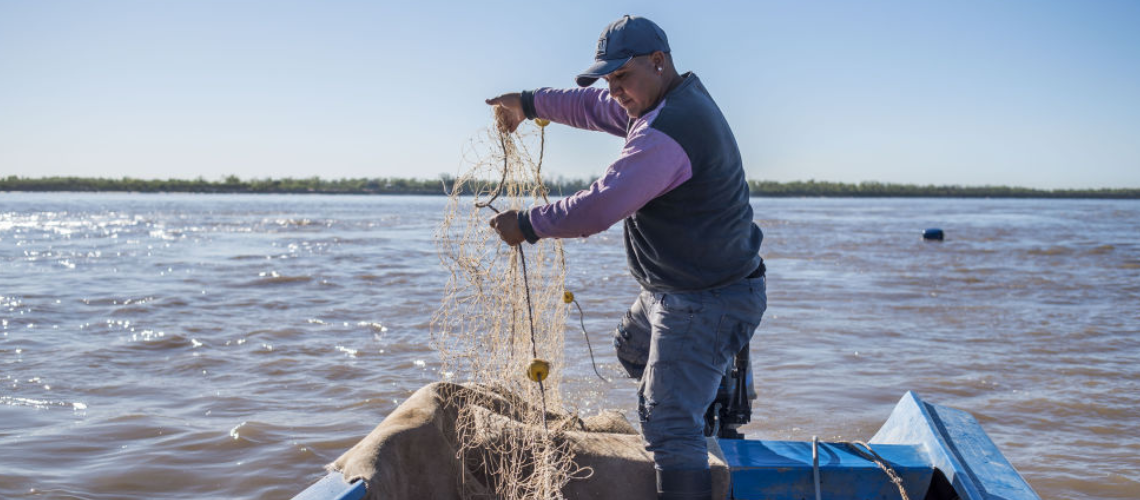
 Pescadores en el río Paraná, en febrero de 2022.
In a context where we see thousands of Paraguayans affected by extreme weather events such as river floods and heat waves, reactive responses are not enough to cope with the negative impacts. Identifying who is most at risk is essential for developing robust and proactive emergency plans.
In this blog we share preliminary results of a study that is being conducted by the World Bank as part of the Poverty and Equity Assessment. It combines geolocated household survey data with flood risk and extreme heat risk maps to identify vulnerable populations and contribute to the design of policies to improve resilience to climate shocks.
Paraguay’s climate has undergone significant changes in recent decades. Temperatures have risen, the number of heat waves has tripled, and droughts and floods have become more frequent . In 2019, the country experienced not only the hottest year in its history but also extreme droughts, floods, and heat waves.
Extreme heat, floods, and drought: Major risk factors
Periods of drought and floods in Paraguay are associated with sharp reductions in Gross Domestic Product (GDP) per capita and with increased poverty (Figure 1). This is partly because climate change poses a risk to the main income-generating sectors (agriculture, livestock and, to a lesser extent, energy production), and therefore to the country’s efforts to reduce poverty.
Figure 1 - Annual changes in per capita GDP growth (%), poverty rates (p.p.), and external shocks
Source: Estimated by a World Bank team using data from the World Development Indicators and the Emergency Event Dataset (EM-Dat)
Despite the growing problem of flooding and extreme heat in Paraguay, little is known about the areas at greatest risk, as well as their potential impact on vulnerability and poverty.
Vulnerability to poverty
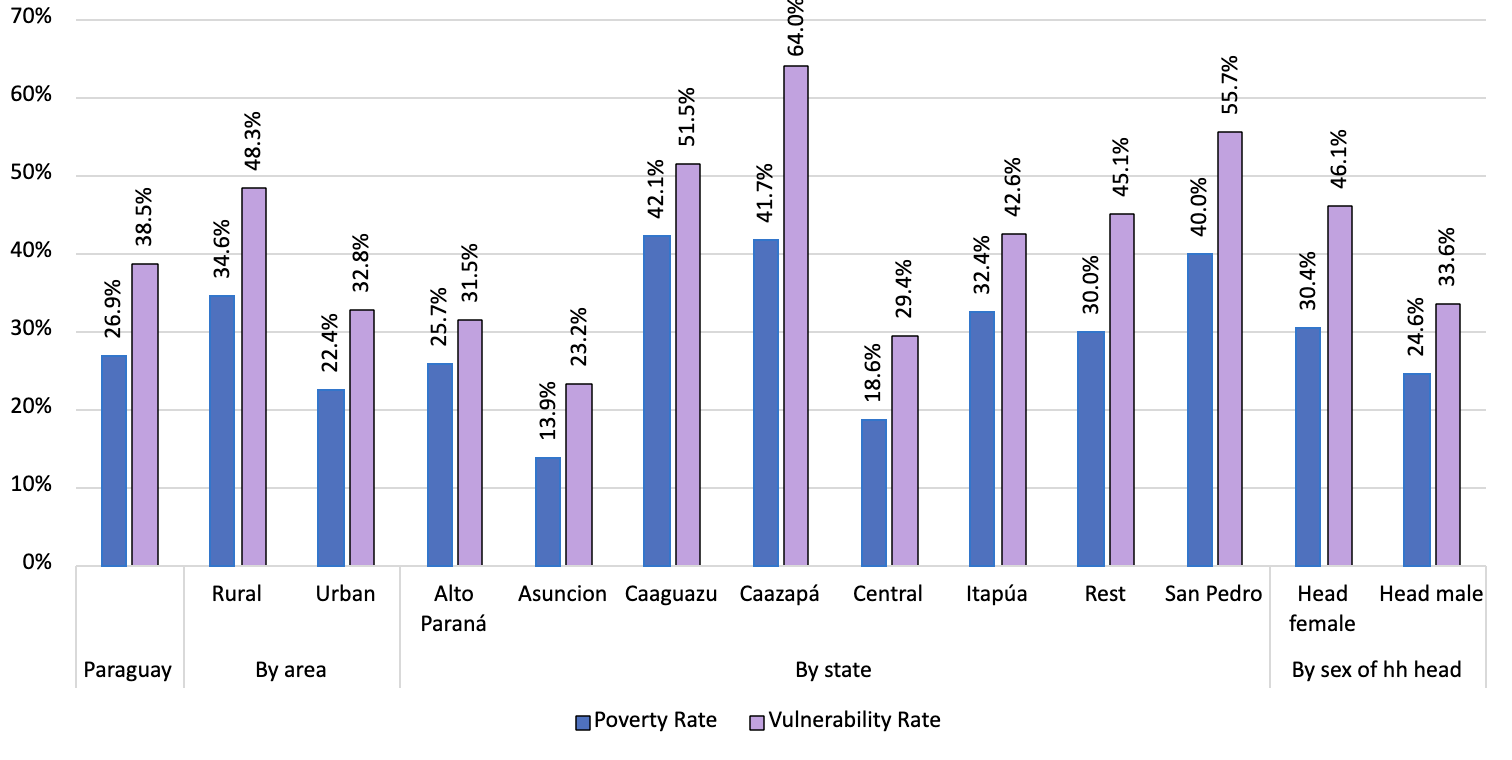
The study uses an innovative definition to determine a person’s vulnerability to falling into poverty. The calculation is based on the income characteristics of households and on their probability of falling into poverty in the event of a negative shock. This measure incorporates the probability that even households that are not poor may fall into poverty as a result of a negative shock. Estimates show that—with a 50 percent probability—4 out of 10 Paraguayans could fall into poverty at any time in the next two years. Notably, the vulnerability rate is higher in rural areas than in urban areas. Also, the poorest departments, such as Caaguazú, Caazapá, and San Pedro, are also the most vulnerable. Likewise, such a shock would affect female-headed households more.
Figure 2 - Poverty and vulnerability rates by areas of residence, representative states, and sex of the head of household

Source: Estimated by a World Bank team using data from the EPH 2021
Disaster risk maps combined with georeferenced surveys allow us to identify not only the probability and severity of extreme climate events, but also the areas and households vulnerable to such weather events.
In this study, we focus on extreme heat and floods, as these climate events pose the greatest risk to the country.
A large portion of the Paraguayan population is at high risk of suffering from extreme heat. In a minor event (with a probability of 20 percent in any given year) for example, almost 40 percent of the population could experience severe extreme heat (Figure 3), with a higher proportion in urban than rural areas. One of the most striking findings is that the entire population of Asunción is exposed to severe extreme heat, both in minor and major events.
Figure 3 - Population at risk of extreme heat (%) by return period, area, and department of residence
Source: Estimated by a World Bank team using data from the EPH 2021 and Vito’s extreme heat risk maps
Floods have a lower risk exposure: 2 out of 10 Paraguayans are at risk of river or rain flooding. The risk varies regionally and by type of flood (Figure 4); for example, 3 percent of the urban population is at risk of river flooding compared to 1.7 percent in rural areas.
Figure 4 - Population at risk of flooding (%), by type of flood, area, and department of residence

Source: Estimated by a World Bank team using data from the EPH 2021 and Fathom’s flood risk maps
Nonetheless, the risk of flooding disproportionately affects poor and vulnerable populations, especially in urban areas. One possible explanation is that urban areas in Paraguay are more densely populated and have less available land, so many poor and vulnerable families tend to settle in places with higher risk of severe weather events. Approximately 26 percent of the urban population at risk of flooding is living in poverty.
Climate changes experienced in the country represent a call to action
In a context of multiple shocks related to climate change, having accurate information will enable the design of public policies to transition from today’s reactive measures to more proactive measures, thereby reducing their negative impact on the most vulnerable.
This is why the World Bank is collaborating with the Ministry of Social Development (MDS) in updating the National Poverty Reduction Plan, which will incorporate a Climate Change Risk Management and Adaptation Strategy (Estrategia Social de Adaptación y de Gestión de Riesgos al Cambio Climático) as part of its strategic focus areas. This update will be evidence-based, leveraging the MDS territorial approach model that promotes climate resilience with a sustainable approach through pilot projects.
Stay updated with our weekly article
Related articles:


Join the Conversation