There is a unique space where you can encounter everyone from developers of self-driving cars in Silicon Valley to city planners in Niamey to humanitarian workers in Kathmandu Valley: the global OpenStreetMap (OSM) community. It comprises a geographically and experientially diverse network of people who contribute to OSM, a free and editable map of the world that is often called the “Wikipedia of maps.”
What is perhaps most special about this community is its level playing field. Anyone passionate about collaborative mapping can have a voice from anywhere in the world. In the past few years, there has been a meteoric rise of locally organized mapping communities in developing countries working to improve the map in service of sustainable development activities.
The next opportunity to see the OSM community in action will be the November 14th mapathon hosted by the Global Facility for Disaster Reduction and Recovery (GFDRR)’s Open Data for Resilience Initiative (OpenDRI). Mapathons bring together volunteers to improve the maps of some of the world’s most vulnerable areas, not only easing the way for emergency responders when disaster strikes, but also helping cities and communities plan and build more resiliently for the future.
GFDRR’s engagement with local OSM communities
The 2010 Haiti earthquake served as a wake-up call about the need for access to better quality information for reducing vulnerability to natural hazards and climate change impacts. In the years since, OpenDRI has turned to the OSM platform as an important way to bring people together to create open data, learn new skills, and support the human networks that eventually become key actors for resilience. We can gather people in a room around something exciting, like a mapathon, and start a conversation about sharing information for the benefit of everyone.

Any data, technology, or tool is only as valuable as the way and the extent to which people use it , and that’s why building sustainable mapping communities is so critical for this work. Even as we engage governments to promote the use of open data and open source tools, OpenDRI also strives to nurture local communities of OSM users and developers from universities, NGOs, and innovation hubs. To that end, OpenDRI supports local OSM communities and conferences like “State of the Map” whenever possible, particularly by funding scholarships for attendees who would not otherwise get to attend, learn, and share knowledge.
Participatory mapping in Asia and Africa
OpenDRI started its work with OSM by supporting the growth of local mapping communities in Indonesia, the Philippines, Nepal, Bangladesh, and Sri Lanka, including through the Open Cities Project. Many of these communities were quick on their feet to respond to the devastating 2015 earthquakes in Nepal. More than 6,000 volunteers helped add data to the OSM platform, mapping up to 80 percent of affected zones, an effort which continues to provide invaluable information to emergency response and preparedness efforts.In the years since, OSM communities across Asia have come together to exchange knowledge and build connections at a series of open source mapping conferences. The fourth “State of the Map Asia” conference will take place in Bangalore, India, this month.
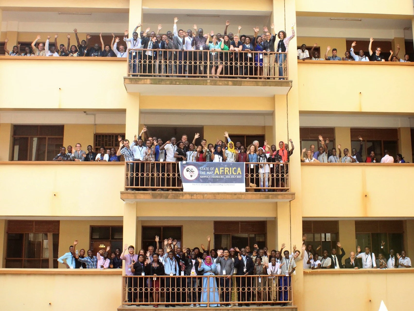
In Africa, the stakes for OSM are even higher, because it is often the only digital map available for many locations. Recent years have brought a rise of participatory mapping communities across Africa, which now total more than 30 active local OSM groups. Africa’s first-ever “State of the Map” conference was held in Kampala, Uganda in 2017.
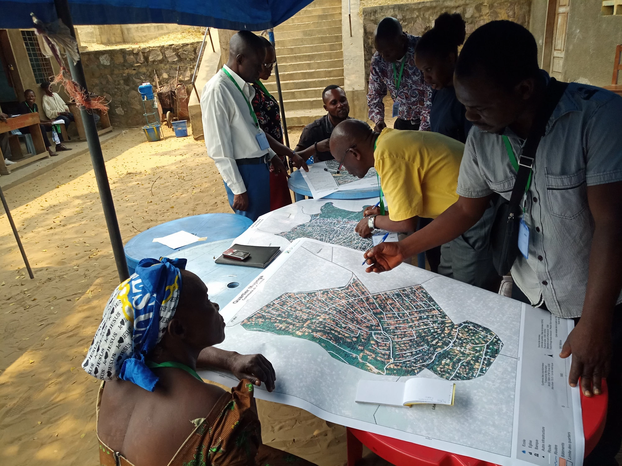
Building on that momentum, OpenDRI recently launched the Open Cities Africa project, currently supporting the development of teams in 11 cities across Africa. These teams are taking the lead in collecting data remotely and on-the-ground through participatory mapping, thus building mapping capacity in their local OSM communities. They are also collaborating with World Bank teams to use the new OSM data to help address a range of development challenges, from urban flooding in Kinshasa to coastal risk management in Senegal. Drawing on our experiences in Asia, we are incorporating novel approaches in our engagement in Africa, including online learning, gender integration, disruptive technologies, and design research.
What’s next for local OSM communities?
Local OSM communities are hopeful that the future will see a larger and more diverse population of mappers worldwide – this will be key to improving the “Wikipedia of maps” even further. As technology giants join the global OSM community, we are now exploring how new machine learning mapping techniques might complement and amplify the work of local OSM communities.
Over the past seven years, the OpenDRI team has been hard at work to create local communities around open-source mapping as part of our drive to promote open data for resilience, and that effort will continue.
To discover the OSM community for yourself and learn more about the benefits of using geospatial data for addressing the world’s most critical development challenges, join us on Wednesday, November 14 for the OpenDRI mapathon at the World Bank.
READ MORE
- Open Data for Resilience Initiative
- Open Cities Africa Project
- Understanding Niamey’s flood risk through open source mapping, drones, and modeling
- Need better maps? Take it to the crowd!
- Mapping and measuring urban places: Are we there yet?
- Subscribe to our Sustainable Communities newsletter
- Follow @WBG_Cities and @GFDRR on Twitter




Join the Conversation