
News headlines often feature stories of water scarcity challenges and increasing competition for water. So it is clear that we need to improve the efficiency and effectiveness of water systems globally – especially in the realm of irrigation management, the water we use to grow our food. However, a data gap exists about evapotranspiration (ET) which, if fixed, would help us understand the amount of water available and used in irrigation and would help us to have more accurate water balances at the basin level.
ET is the process by which water is transferred from the land to the atmosphere. It is the sum of evaporation from the land surface, plus transpiration from plants. It is central to the earth’s water cycle, and the largest user of water in many arid regions around the world. For irrigated agriculture, ET is a measure of the water used – and not returned to the system through, say, drainage or run off - to grow food. Understanding evapotranspiration is important for determining things like agricultural water consumption, assessing drought conditions, monitoring crops, and developing water budgets – to name just a few.
However, it has been a challenge to find reliable, robust, and efficient methods of measuring ET. Even if the data is made available, it is difficult for most water users and decision makers to access, process, and analyze this often limited and expensive ET data. But this is changing now thanks to new efforts.
That’s because satellite remote sensing data makes it possible to estimate evapotranspiration and bridge the data and data access gap. In the past decade, remote sensing applications have been undergoing significant technological and methodological development to improve decision making and improve data accuracy with limited capacity.
In parallel, many challenges remain, including limited capacity of government counterpart agencies, and lack of time and staff to process massive amounts of data. Additionally, investments in water quality monitoring and hydrometeorological stations have significantly declined.
To this end, ET is an important component of the work of the Global Water Security and Sanitation Partnership (GWSP). With over 20 partners, the Global Initiative on Remote Sensing for Water Resources Management focuses on bringing innovative remote sensing applications into World Bank projects and government agencies ; working to make operationalize them, and produce knowledge for sustainable implementation. GWSP and partners have supported a number of initiatives and projects to help expand ET-based irrigation practices.
The Provision for Advisory for Necessary Irrigation (PANI) is a pilot project in India that is using satellite-based rainfall data, temperature information, and seven-day weather forecasts. PANI supports a very large investment water project and provides irrigation advisories to farmers via cell messages to reduce overwatering and increase crop yields. The farmers receive a text message that provides information on when, where, and how much to irrigate.
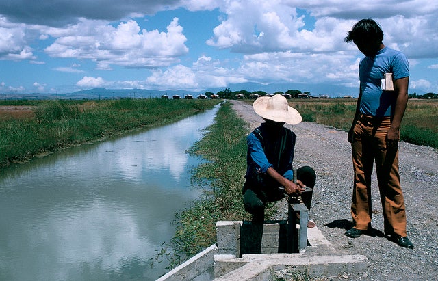
In Mexico, satellite data is supporting a very large irrigation district to monitor crop types throughout the year and visualize evapotranspiration, enabling local stakeholders to see the field plots that evaporate more than others and target technical assistance to areas most in need. This prevents inefficiency with dwindling subsidies and limited government support. The national border agencies of Mexico are using this information to improve public spending and public support for farmers in this area.
One of the most transformative initiatives is OpenET, a collaborative effort between the Environmental Defense Fund, NASA, Google Earth Engine, and the Desert Research Institute, which aims to provide open and easily accessible ET data for improved water management. OpenET includes a set of web applications that leverage a mix of very different technologies (including cloud storage) that make low cost ET estimations more accessible to clients. OpenET provides free algorithms that allow clients to quickly and frequently find out critical information such as current hydrological conditions.
ET data provides significant contributions to agricultural water management – whether through supporting the financial viability of farms during droughts or developing accurate water budgets. GWSP connects a global platform of diverse stakeholders that would not normally work together to create something unique and impactful for farmers around the world.
 This blog is part of the“Water Flows” blog series, showcasing examples of work
funded by Global Water Security & Sanitation Partnership (GWSP).
The GWSP gets knowledge flowing to and from implementation via first-rate research and analysis.

Join the Conversation