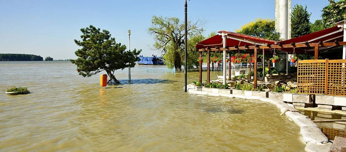
 Floods on the Danube Promenade in Romania.
Romania is a flood-prone nation. Since 2000, floods have killed over 240 people in the country. The 2005 and 2006 floods alone affected over 1.5 million people, killing 93, destroying an important part of the country’s flood risk management infrastructure, and causing estimated damages of over €2 billion. A recent flood risk assessment by the Romanian Ministry of Environment, Water and Forests, the National Administration “Romanian Waters,” and the World Bank estimates that the average annual expected damage of riverine flooding, flash floods, urban and coastal floods may add up to €1.7 billion, affecting up to 150,000 Romanian citizens every year in the country’s 526 identified areas of potential significant flood risk. Climate change will further increase these risks.
To manage its flood risks, Romania, with the support of the World Bank, developed new Flood Risk Management Plans for its 11 river basins and for the Danube River, in line with the requirements of the EU Floods Directive. The Flood Risk Management Plans were prepared using updated Flood Hazard and Risk Maps, an improved flood risk assessment, and an innovative methodology for the identification, appraisal, and prioritization of measures. The new plans now lay out a more integrated approach with measures to improve flood prevention and protection, as well as to strengthen capacities for flood preparedness, response, and recovery, ultimately helping Romania to further build resilience.
Flood risk assessment
The basis of sound flood risk management is the systematic assessment of flood risks. With the new flood hazard maps, a comprehensive data set of exposed elements created with aerial images and innovative machine learning techniques, and a newly developed damage and loss database, Romania was able to calculate and map out potential flood damage and risk. This approach allowed for an estimation of the impact of floods on domestic properties, social infrastructure, and transport infrastructure, as well as an estimation of total damage in monetary terms (see Table 1).
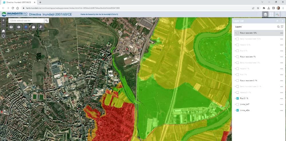
These very high-resolution results (see Image 1 below) allow the country to assess the potential damage in each risk class, identify “hot spots”, and provide the needed information to prioritize and justify investments in flood risk reduction.
Image 1: Flood Risk Map as presented in the Romanian Web Viewer (https://inundatii.ro/en/maps-portal/)
Identifying solutions to reduce flood risks
Identifying solutions and developing new plans was centered around the catalog of measures that Romania prepared based on prior experience and existing guidance from the European Commission. After identifying viable measures using this catalog, Romania’s River Basin Administrations developed integral solutions with prevention and protection measures. With multi-criteria analysis, cost-benefit-analysis, and data from the improved flood risk assessment, Romania was able to properly appraise the proposed solutions, further enhance them and prioritize the most effective ones.
Romania also identified a set of non-structural measures to strengthen flood risk management at the national level. This includes measures to improve flood preparedness and emergency response and recovery, such as better early warning systems or enhanced response capacities of civil protection. They also include proposed policy changes, for example, for urban and spatial planning that avoid creating new flood risks.
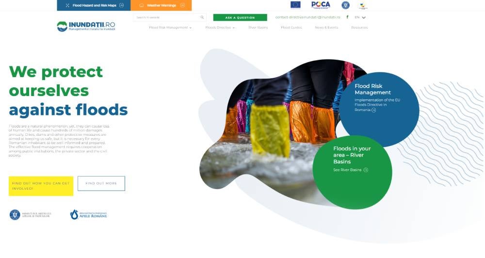
Relevant institutional stakeholders were actively involved in the identification and selection of the different measures. Public consultations to discuss proposed measures were held at the river basin and the national level. All relevant information, including the new Flood Hazard and Risk Maps and the proposed measures were made available during the planning process on a dedicated website.
Image 2: Romania’s website on flood risk management (https://inundatii.ro/en/)
Nature-based solutions
Green infrastructure and nature-based solutions for flood risk management, such as setting back dikes and providing more room for the river, result in multiple benefits in addition to flood risk reduction. These can include the conservation of biodiversity, enhanced groundwater recharge or carbon sequestration. Furthermore, these solutions help to adapt to climate change.
Romania has now started to shift its focus from flood protection using “gray” infrastructure to greener solutions. Maps identifying the potential for nature-based solutions and guidelines for greener approaches have helped Romania spot many opportunities to effectively manage flood risks with the support of nature. To protect the locality of Luncavița, for example, the country recommends the removal of a legacy dam to create natural water retention areas and restore two wetlands. This will lower the flood risk for the urban area and provide a positive impact for biodiversity, creating new habitats for flora and fauna in the immediate vicinity of the Danube Delta.
The new flood risk management plans
With the new plans, Romania sets the basis for more effective flood risk management, integrating structural and non-structural measures, traditional flood protection infrastructure, and nature-based solutions. Together, the twelve plans contain a total of over 2000 different measures. If implemented, they would reduce the annual expected damage by over €900 million. The timely implementation of all identified measures will be very challenging, especially considering the available financial resources. Based on the consistent appraisal, Romania selected the most effective projects to substantially reduce flood risks in vulnerable areas for immediate implementation. In this regard, the country has already identified 30 high-priority projects for detailed assessment and further planning that will protect an additional 90,000 persons who are currently at risk.
The variety of instruments and methodologies used for planning and the wealth of information gathered will also be used for future updates of the plans, which will be carried out every six years, in line with the EU Floods Directive. Romania and the World Bank teams who provided support throughout the process gained a considerable amount of knowledge and experience, which has already been shared with other EU Member States for their flood risk management planning and with other countries across the globe where the Bank is providing similar support.
Related Links:
Flood hazard and risk maps: A key instrument for flood risk management
Opinion: To Outpace Climate and Disaster Risk, Romania Is Counting on Innovation
Europe and Central Asia: Country Risk Profiles for Floods and Earthquakes


Join the Conversation