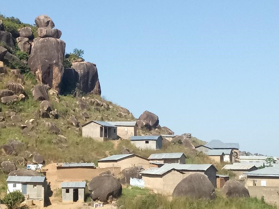
Like many urban areas in Africa, the city of Ngaoundéré, Cameroon has seen a rapid increase in its population, from roughly 180,000 in 2005 to almost 290,000 in 2020. This urban growth has been largely unplanned, with rural migrants often occupying areas within flood plains or along mountain slopes, vulnerable to flooding and rock falls. Such disasters regularly wreak havoc on citizens’ lives and lead to increased exposure to disease, food shortages, and financial vulnerabilities. This nexus of rapid, unplanned urban growth and increased exposure to natural hazards is especially problematic for local governments who lack data to formulate accurate and efficient policy responses. How do you address a problem you cannot measure?
Over the last two years, inputs from a diverse range of stakeholders have increased the availability of data and led to the production of a tangible Risk Atlas, which the Ngaoundéré City Council (NCC) is now using to inform urban management and planning.
Closing the information gap
In 2018, Ngaoundéré was selected as one of 12 cities to participate in Open Cities Africa, an initiative of the Global Facility for Disaster Reduction and Recovery (GFDRR) that supports the collection of open-source risk information through citizen engagement and the development of data products to support local decision-making.
In Ngaoundéré, this approach allowed the team to map over 300 km² of urban area combining inputs from local residents, with data from the municipality and new drone imagery. All this is now available online through the Risk Atlas and in OpenStreetMap. The initiative was coordinated with the World Bank-financed Cameroon Inclusive and Resilient Cities Project (CIRCP) that is being implemented by the Ministry of Housing and Urban Development (MINHDU).
Local engagement leads to community ownership

Photo: Mohamadou Arabo
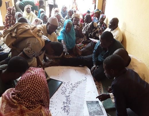
The Open Cities Ngaoundéré project prioritized stakeholder engagement from the beginning. Its lead implementer, the Association for Resource Management Mapping (ACAGER), consulted with 30 local groups, including government departments, civil society organizations and community associations operating in risk-prone areas. Community members who had never been engaged in urban management are now more aware of the challenges and take ownership and responsibility for actions that affect the areas where they work and live.
We were able to show them the number of houses in each neighborhood, which ones were at risk and explain what actions can be taken.
Communities now organize weekly “Jeudi Propre” (Clean Thursday) gatherings to pick up trash, to prevent drainage systems from clogging, and they have requested that drone flights be used to regularly monitor new construction in flood-prone areas.
How students revived municipal data collection

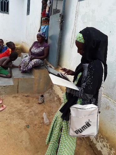
Photo: Gaëlle Nodjignemal Goltob
This role strengthened their technical skills and provided them with a hands-on opportunity to contribute to community development efforts. The use of students was especially effective because they spoke the local language, Fulfuldé, and understood the social and cultural norms around approaching households.
The contributions of these young mappers did not go unnoticed by local government officials. Ahmad Barngawi Mohammad, the Urban Planning, Architecture and Building Permit Manager at the NCC told us that the commitment of the young people was the thing that impressed him most. While for a very long time the project couldn’t gather this data, today, the project is gaining momentum thanks to its easy and accessible approach.
Better data for targeted decision-making

funding to upgrade its drainage infrastructure.
Photo: Gabriel Amougou
The updated data has helped local authorities demonstrate the challenges in Ngaoundéré and successfully advocate for central government funding to invest in risk mitigation, for instance in adjusting waterways to improve stormwater runoff.
The NCC is also exploring the use of the data for broader purposes, such as the development of an own-source revenue system to manage property taxes.
Based on the success in Ngaoundéré, a similar project to map risk-prone areas was launched in Cameroon’s capital, Yaoundé. The U.S. Department of State also supported participatory mapping in Douala, through its Secondary Cities program.
The accomplishments of the Open Cities Ngaoundéré project can be attributed to its collaborative approach that recognized the value of numerous stakeholders: when it comes to urban management and resilience, everybody has a role.

Note: Open Cities Africa being financed by the EU-funded ACP-EU Africa Disaster Financing Program.


Join the Conversation