
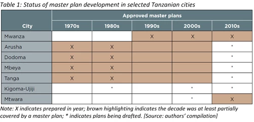
To shed light on these questions, we attempted to investigate the impact and effectiveness of urban planning on city spatial development in seven Tanzania secondary cities using a variety of spatial analytical tools and satellite and remote sensing imagery.
We observed that early master plans are somewhat successful in providing broad guidance on each city’s population projections and main structural forms. However, they were implemented only to a limited extent or proved rather ineffective in concretely guiding development, especially in terms of major land uses and supporting infrastructure and facilities.
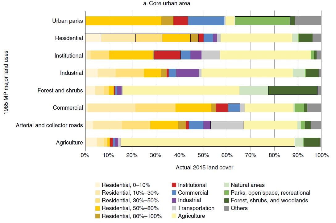
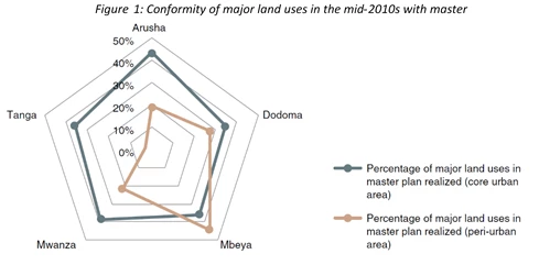
For example, we assessed the degree to which various types of land uses align with previous master plans, in the city center versus peri-urban areas. Interestingly, we found that overall, the levels of land use conformity to historic master plans are low (less than 50%). In city centers, these are consistently around 35%-45%, while that in peri-urban areas varied significantly (see Figure 1, 2 and 3).
Further, cities with master plans existing from earlier decades did not show better conformity compared to cities that adopted master plans later; over time, this conformity did not change or improve significantly either. However, notably, residential conformity in core urban areas is generally high (ranging from around 48 percent to 78 percent conformity), while economic uses (commercial and industrial areas) have relatively lower levels of conformity—averaging around 17 percent and 25 percent, respectively.
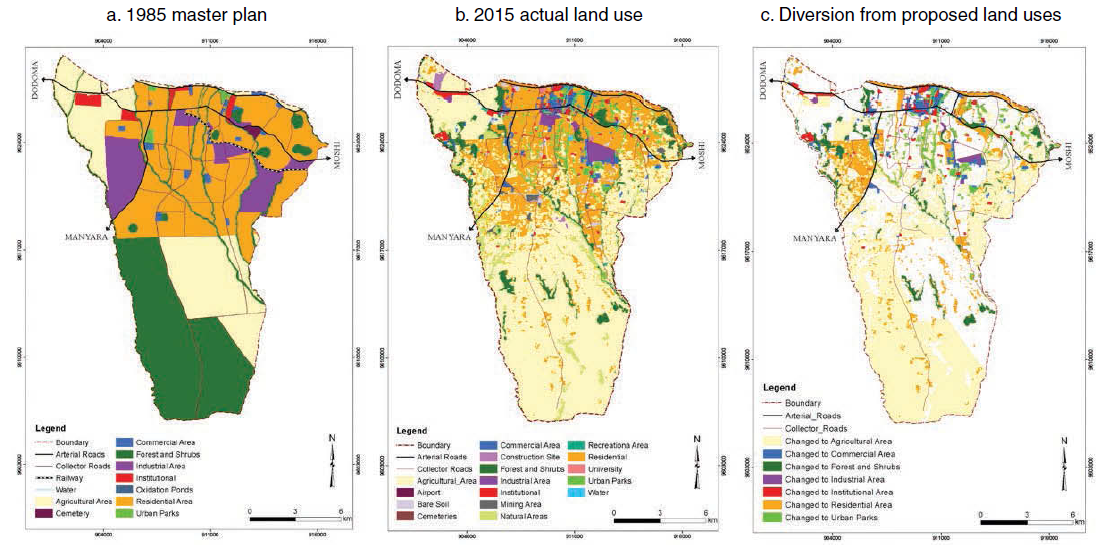
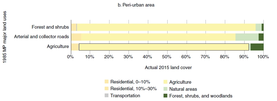
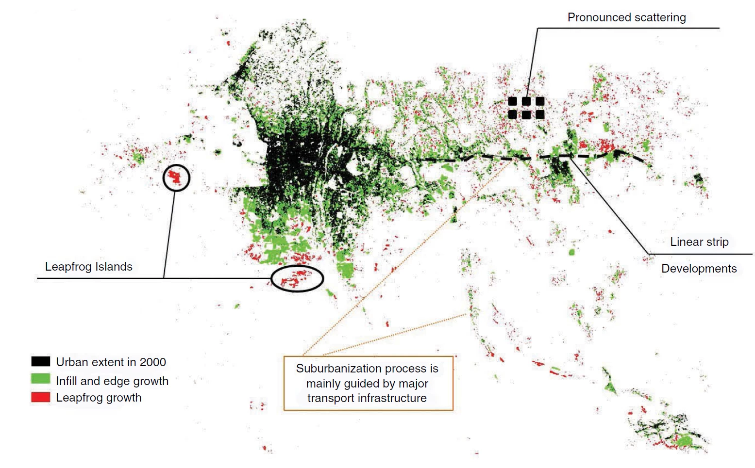
We further observed that many of our case cities faced increased fragmentation and dispersion, with the urban expansion process strongly aligned with development of major roads, forming ribbon developments or leapfrogged islands. This is especially pronounced in peri-urban areas. Further, these cities all have sizeable unplanned settlement areas and continue to experience significant expansion (from around 20%-30% growth) with little conversion into planned settlements.
- Inherent weaknesses in the master plans themselves;
- Disconnect between spatial planning, sector or infrastructure plans and budgeting and investment planning decisions;
- The lack of coordination among key agencies;
- Lack of or ineffective development controls;
- Unrealistic planning standards and regulations; and
- Limited capacity and resources for enforcement;
Solutions and approaches to planning therefore need to be innovative but also practical. Also, more can be done to empower local authorities as they have the keenest on-the-ground knowledge. What do you think could help to improve the effectiveness of master plans in your city?
Find our full report here: Translating Plans to Development: Impact and Effectiveness of Urban Planning in Tanzania Secondary Cities.
Acknowledgment note: Support to this study was provided by GAF under the European Space Agency (ESA)’s Earth Observation for Sustainable Development (EO4SD) initiative’s dedicated activity cluster on urban development.
Related links:
- Report: Translating Plans to Development: Impact and Effectiveness of Urban Planning in Tanzania Secondary Cities
- Subscribe to our Sustainable Communities newsletter
- Follow @WBG_Cities on Twitter


Join the Conversation